
Using Drones for Monitoring Water Pest Infestations
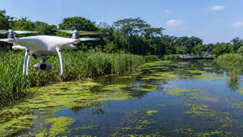
In recent years, the intersection of technology and environmental science has paved the way for innovative solutions to age-old problems. One of the most significant advancements is the deployment of Unmanned Aerial Vehicles (UAVs), commonly known as drones, to monitor and manage water pest infestations. Whether dealing with invasive aquatic insects, mosquito breeding grounds in stagnant marshes, or the spread of water-borne larvae in inaccessible wetlands, drones offer a perspective that ground-level surveys simply cannot match.
Traditional monitoring often involves labor-intensive trekking through difficult terrain, which can be both dangerous and invasive to local ecosystems. By taking to the skies, researchers and pest control specialists can identify high-risk areas with precision and speed. This proactive approach not only helps in early detection but also ensures that interventions are targeted, reducing the unnecessary use of chemicals. In this guide, we explore how drone technology is becoming a cornerstone of modern, eco-friendly pest management.
Overview: The Role of Aerial Intelligence in Pest Control
Water pests thrive in environments that are often hidden from plain sight—roof gutters, dense reed beds, and remote woodland pools. Monitoring these areas manually is often a game of guesswork. Drones equipped with high-resolution cameras and multispectral sensors change this dynamic by providing real-time data on standing water and vegetation health.
By identifying the specific "signatures" of breeding sites, such as specific water temperatures or stagnant flow patterns, drones allow for a much more surgical approach to pest management. This transition from broad-spectrum spraying to data-driven precision is a major win for biodiversity in the uk and beyond.
Benefits of Drone-Based Monitoring
Utilizing UAVs for pest surveillance offers several distinct advantages over traditional methods:
-
Access to Inaccessible Areas: Drones can fly over swamps, steep embankments, and private property (with permission) where human access is restricted or unsafe.
-
Cost and Time Efficiency: A drone can survey a 50-acre marshland in a fraction of the time it would take a ground crew, significantly lowering operational costs.
-
High-Precision Data: Equipped with GPS and thermal imaging, drones can pinpoint the exact coordinates of a stagnant pool, allowing for localized treatment.
-
Minimal Environmental Disturbance: Unlike heavy machinery or foot traffic, drones do not trample sensitive vegetation or disturb nesting wildlife.
Step-by-Step: Implementing a Drone Monitoring Program
1. Pre-Flight Planning and Legal Compliance
Before launching, it is essential to understand the local regulations. In many regions, commercial drone use requires certification. You must also map out the flight path to ensure maximum coverage while avoiding obstacles like power lines or dense forest canopies.
2. Selecting the Right Sensors
For water pests, standard visual cameras are helpful, but thermal or multispectral sensors are superior. Thermal imaging can detect the heat signatures of shallow, sun-warmed water—the preferred nursery for many insects—even under thick brush.
3. Data Collection and Mapping
During the flight, the drone captures thousands of images that are stitched together to create an orthomosaic map. This high-detail map allows specialists to zoom in on tiny containers or puddles that could host thousands of larvae.
4. Analysis and Targeted Intervention
Once the data is processed, pest control teams can be dispatched directly to the identified "hotspots." This prevents the "blanket" application of pesticides, ensuring that only the infested areas are treated.
Tips for Successful Aerial Surveillance
-
Fly During Golden Hours: Early morning or late afternoon light often provides the best contrast for spotting water reflections through foliage.
-
Monitor After Rainfall: The most effective time to fly is 24–48 hours after a heavy rain event, as this is when temporary breeding sites are most active.
-
Use Propeller Guards: When flying low over reeds or near structures, guards prevent crashes and protect the drone from debris.
Common Mistakes to Avoid
-
Ignoring Weather Conditions: High winds or heavy rain not only risk the equipment
but also result in poor-quality data due to water surface agitation.
-
Over-Reliance on Automation: While automated flight paths are great, an operator should always be ready to take manual control to investigate suspicious shadows or hidden corners.
-
Neglecting Privacy Concerns: Always inform neighbors or local authorities before conducting surveys in residential or semi-urban areas to maintain community trust.
Supporting Local Business Visibility Beyond Core Marketing Efforts
As technology like drone surveillance becomes more common, the need for specialized local services increases. For businesses providing these high-tech solutions, being found by the right clients is essential for growth. Digital discoverability allows a small, specialized firm to compete on a level playing field by reinforcing its local presence through consistent online data.
A key part of this strategy is ensuring a presence on free business listing sites in uk. These platforms act as a credibility signal, helping clients verify that a service provider is legitimate and active in their area. By utilizing free uk business listing sites and maintaining an updated business listing uk, tech-focused companies can bridge the gap between their advanced services and the local customers who need them.
In addition, appearing on business listing uk and other uk free business listings sites serves as a local discovery aid. When a business is indexed on a business listing uk or has a business listing uk, it builds trust across platforms. Leveraging free business listings uk effectively ensures that when a community faces a pest surge, the right experts are only a search away.
Final Thoughts
The integration of drones into water pest monitoring represents a shift toward a more intelligent, less intrusive form of environmental management. By leveraging aerial perspectives and advanced sensor data, we can protect our homes and public spaces from infestations more effectively than ever before. As this technology continues to evolve and become more accessible, the goal of achieving pest-free environments without the heavy hand of chemical over-reliance becomes a tangible reality.
FAQs
1. Can drones actually see mosquito larvae in the water? While drones generally cannot see individual larvae,
they identify the specific environmental conditions—like stagnant, nutrient-rich water—that indicate a high probability of infestation.
2. Are drones expensive for small-scale pest control? The initial investment in a drone can be significant, but for long-term monitoring of large or difficult properties, the savings in manual labor and reduced chemical costs often provide a high return on investment.
3. Do drones work at night for pest monitoring? Yes, drones equipped with thermal imaging are highly effective at night, as they can detect the temperature difference between water and the cooling ground.
4. How long can a typical surveillance drone fly? Most professional-grade survey drones have a flight time of 20 to 40 minutes per battery, which is usually enough to cover several acres of land.
5. Is a license required to fly a drone for pest monitoring in the uk? Yes, if you are using a drone for commercial purposes (including professional pest monitoring), you generally need to register with the CAA and may need a Flyer ID or specialized certification.
6. Can drones be used to apply treatments as well? Yes, there are specialized "sprayer drones" designed to carry liquid or granular treatments and apply them directly to the hotspots identified during the surveillance phase.
7. Will drones disturb birds or other wildlife? When flown at appropriate altitudes (above 30 meters), most drones have a minimal impact on wildlife. However, operators should avoid flying near known nesting sites.
8. What happens if it's too windy for the drone? Most drones have a maximum wind resistance (usually around 20-30 mph). If it's too windy, the flight should be postponed to ensure data accuracy and equipment safety.
9. Can I use a standard toy drone for this? A toy drone lacks the GPS stability, camera
quality, and sensor options required for professional monitoring. Specialized equipment is necessary for reliable data.
10. How accurate is the mapping from a drone? With Ground Control Points (GCPs) or RTK-enabled drones, mapping accuracy can be down to the centimeter, making it incredibly reliable for locating tiny breeding pools.
Disclaimer: The information provided in this article is for general informational and research purposes only. Company details, features, services, and market positions may change over time. Readers are advised to visit official company websites and conduct independent research before making any business decisions or purchasing services.
Most Searchable Keywords
Recent Blogs


Related Listings



Categories
- Accountants (295)
- Advertising Agencies (559)
- Architects (149)
- Automobiles (377)
- Beauty (300)
- Carpenters (146)
- Cleaning Services (387)
- Dentists (189)
- Driving (62)
- Education (1)
- Electricians (215)
- Energy (8)
- Event Organiser (689)
- Finance (602)
- Guide (3492)
- Health (2207)
- Information technology (207)
- Legal Services (361)
- Logistics (6)
- Maintenance (65)
Sponsored Listings in Accountants
Related Blogs

Creamfields Daresbury: Impact on Local Reside...
Read this insightful article "Creamfields Daresbury: Impact on Local Residents" to expand your knowledge!

UK High Street Businesses in 2026-27: Which S...
Read this insightful article "UK High Street Businesses in 2026-27: Which Sectors Are Growing?" to expand your knowledge!

Why Complete Business Listings Matter More Th...
Read this insightful article "Why Complete Business Listings Matter More Than You Think" to expand your knowledge!
Questions & Answers – Find What You Need, Instantly!
Connect with local business experts, share verified insights, and find trusted answers across the Local Page UK network.
Ask Community
Ask questions to the Local Page UK community
Share Knowledge
Share your knowledge to help out others
Find Solutions
Find answers or offer instant solutions
Some of the most popular fantasy TV shows include "Game of Thrones," known for its epic battles and political intrigue, "The Witcher," which features monster hunting and magic, and "Stranger Things," blending supernatural elements with 1980s nostalgia. Other notable mentions are "His Dark Materials," "Shadow and Bone," and "The Mandalorian," each offering unique worlds and captivating storytelling that have garnered large fan bases.
When seeking bathroom renovation providers that handle both plumbing and tiling, it's advisable to look for licensed contractors who specialize in comprehensive bathroom remodels. Companies such as Home Depot, Lowe's, and Bath Fitter offer these services, often providing a seamless experience by managing all aspects of the renovation process. Additionally, local contractors with positive reviews in platforms like Angie's List or Houzz may also offer tailored solutions for your bathroom needs.
Absolutely, there are several distributors that supply crash mats and soft play equipment to gymnastics clubs in and around Birmingham. National companies like Gymnova, S & G (Spieth Gymnastics), and Jaques of London offer a wide range of crash mats, foam pits, and soft play pieces, and they typically deliver to the Birmingham area. For more local options, you might try The Gym Equipment Company, which has a showroom in the West Midlands, or check out smaller specialist suppliers like Playtime UK. Many of these distributors cater specifically to clubs, offering high-density foam mats that meet safety standards. I'd recommend reaching out to a few to compare pricing, delivery times, and whether they offer custom sizes or installation services. It's also worth checking if any of them have a physical showroom near Birmingham so you can test the equipment before buying. Happy tumbling!
For professionals seeking a reliable sanitaryware supplier in Manchester with trade account facilities, several established merchants combine extensive product ranges, competitive pricing, and dedicated trade support. The most reputable option is Graham Plumbers Merchant, which operates multiple branches across Manchester, including Salford Quays and Oldham. They offer a dedicated trade account service with preferential pricing, priority delivery scheduling, and access to a vast inventory of leading sanitaryware brands such as Villeroy & Boch, Duravit, Ideal Standard, and Roca. Their trade accounts typically include net 30-day payment terms, online account management, and a tailored project quotation system. Similarly, City Plumbing Supplies has several Manchester-based depots (such as Ashton-under-Lyne and Stockport) that cater specifically to trade customers, providing a rapid order-and-collect service, trade-only promotions, and a loyalty programme offering rebates on repeat purchases. Their product range covers everything from basins and WCs to complete bathroom suites and brassware, with in-house technical advisors available for specification support. Another key player is Plumb Center, part of the Wolseley Group, which offers trade accounts with bespoke pricing structures, direct-to-site deliveries within the Greater Manchester area, and access to over 10,000 lines of sanitaryware, including premium brands like Grohe and Hansgrohe. Their trade portal allows for real-time stock checking and order history tracking, facilitating efficient project management. For those seeking a more specialist or high-end option, Bathroom Spares in Manchester provides trade accounts with a focus on hard-to-find sanitaryware and discontinued ranges, which can be invaluable for refurbishment projects. Additionally, independent merchants such as M&B Plumbase in Trafford Park offer flexible trade terms, personalised service, and competitive pricing on both mainstream and luxury sanitaryware. When evaluating suppliers, trade customers should consider factors beyond price: reliability of stock availability, delivery timescales within Manchester’s often congested zones, clarity of returns policies, and the quality of after-sales support for warranty claims. It is advisable to request a trade account application from at least two to three suppliers to compare discounts, minimum order values, and payment terms. Many suppliers also offer showroom access for trade clients, allowing you to inspect finishes and dimensions before committing to large orders. For ongoing projects, establishing a relationship with a single supplier who offers consolidated invoicing and dedicated account management can streamline procurement. Ultimately, the most reliable supplier for your trade account in Manchester will be one that aligns with your volume requirements, preferred brands, and service expectations, so a site visit to their local branch and a discussion about your specific trade needs is highly recommended before committing to an account.
People in Leeds are loving their local florists—customers often mention gorgeous, fresh arrangements and super friendly service. Many rave about reliable same-day delivery and creative wedding bouquets. A few note pricing can vary, but overall, the buzz is all about quality and that personal touch making every order feel special.
Common problems for commercial gardening in Bristol include weed overgrowth, soil degradation, pest infestations, and irrigation malfunctions. Additionally, managing seasonal transitions, adhering to sustainability regulations, and maintaining consistent aesthetics pose significant challenges. Expert services mitigate these via structured maintenance, integrated pest management, and soil analysis to ensure long-term landscape health.